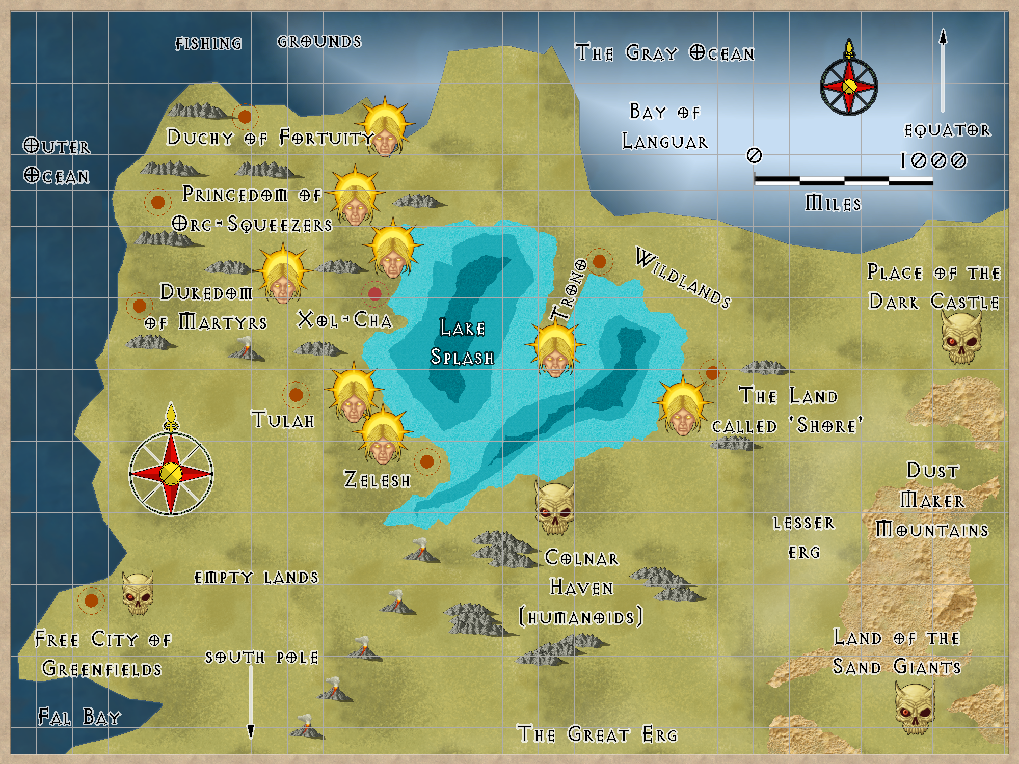
A small kingdom run by a Prince. Alignment: NG and LG.
Location map:
"Welcome to Crest of a Star; these maps and other graphics are only for playing D&D type games. They are copyright and not to be used for other purposes. If you have them on your site, please remove them. Thank you."
Hi and welcome to my Crest of a Star site ! This site is my first edition AD&D materials.
I have added to the maps, people, etc. since I bought Campaign Cartographer 2 around 23 or so years ago. I now have CC3+ and all of its add-ons.
Link in the Home text at the top of this drop down will bring you back to the front page of this site.
My other rpg sites below.
Posted
A small kingdom run by a Prince. Alignment: NG and LG.
Location map:
Author
Bill George
Categories
South Hemisphere
Posted
A neutral good nation that fights the neutral evil corsairs in the Gray Ocean. They have heard of Trillolara, but feel they are too small to ally with.
I like this definition of ‘martyr’: one who suffers for the sake of principle. In this case, the fight against undead and evil pirates.
Location map:
Author
Bill George
Categories
South Hemisphere
Posted
Delta 30,000
Seascape Keyforth 20,000
(city and major town populations will be added later)
Author
Bill George
Categories
South Hemisphere
Posted
A land of orcs and other evil humanoids.
Across Splash Lake from Trono.
Author
Bill George
Categories
South Hemisphere
Posted
An interesting place, if you like dull places.
A city, a castle or two, a few towns, but mostly villages. They know about The Land called ‘Shore’ across the lake, but due to orcs and bugbears in the Wildlands between them, there is no trade.
Not all that many people. Less than 30,000. Mostly humans, but there are a few elves and stout halflings living here.
Some farming, but lots of mountains.
Mostly they fish.
Rather hard to get from the east side of this nation to the west side, or vice-versa. The mountains get in the way. There is one pass, but it is a dangerous way to go, Dagger Pass. Those who use it seldom are seen again.
There is Shagal-Tarn, out at the south end of the peninsula. The gray areas are the mountains.
It is 337 miles, straight line distance, from Shagal-Tarn to the southern most tower. The mountains are 3917 square miles and Trono is 8350 square miles, for a total of 14267 square miles.
Map needs an update.
New map: Feb 4, 2015.
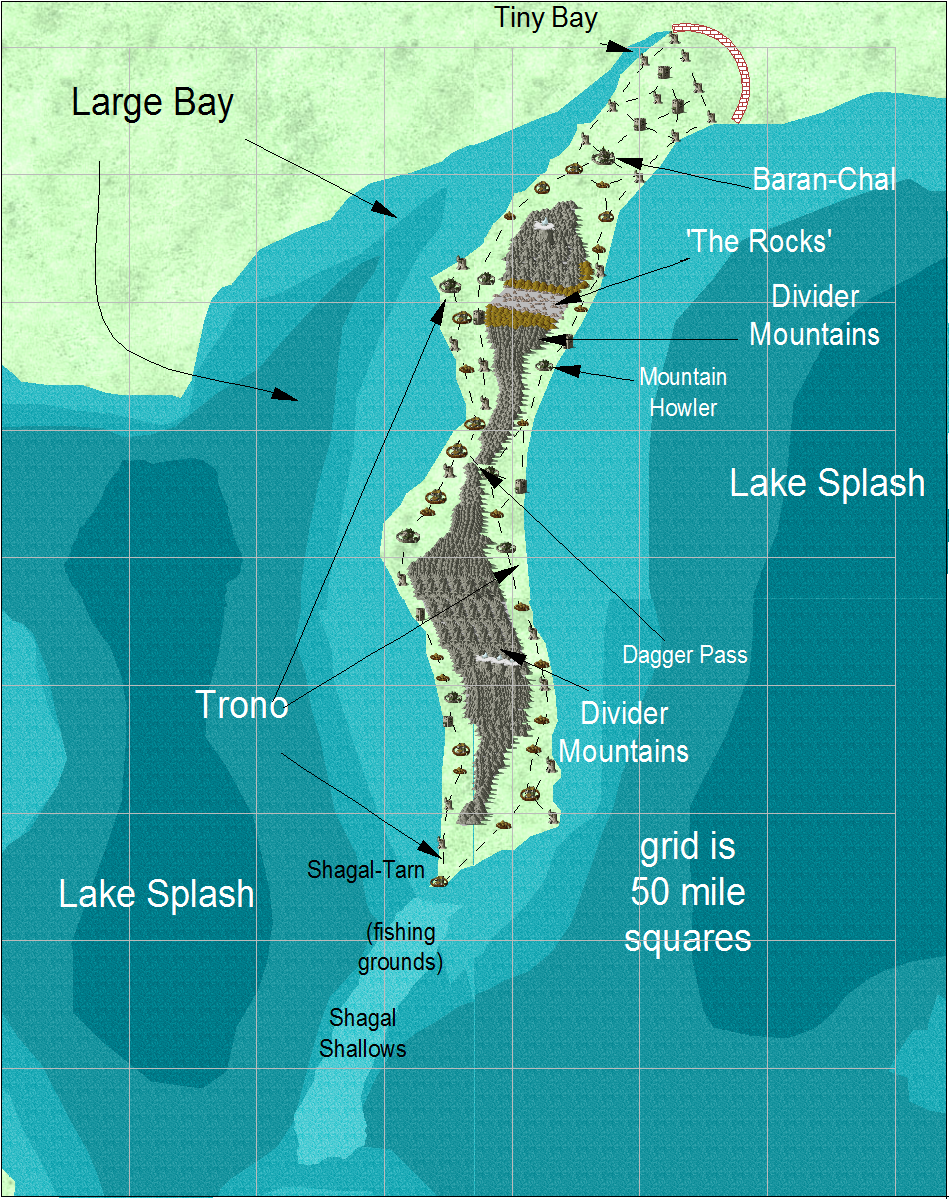
This map shows the new map area:
Author
Bill George
Categories
South Hemisphere