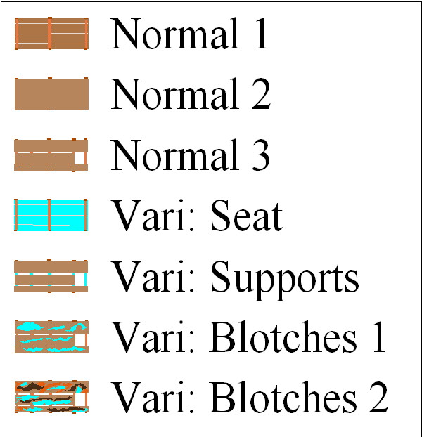
Benches zip file. Click here to download. includes FCW and FSC file: 45 kb Some are vari-symbols.
"Welcome to Crest of a Star; these maps and other graphics are only for playing D&D type games. They are copyright and not to be used for other purposes. If you have them on your site, please remove them. Thank you."
Hi and welcome to my Crest of a Star site ! This site is my first edition AD&D materials.
I have added to the maps, people, etc. since I bought Campaign Cartographer 2 around 23 or so years ago. I now have CC3+ and all of its add-ons.
Link in the Home text at the top of this drop down will bring you back to the front page of this site.
My other rpg sites below.
Posted
Author
Bill George
Categories
Generic, Symbols
Posted
This is very basic information, and presumes you know how to use the software.
1) use Fractal Terrains to draw islands or a world you like.
2) Save as CC3 file, or Export World as Multiple files. Both under the File menu.
3 A) Bring the CC3 file you want to use up into CC3 or CC2. ‘Save As’ a BMP or PNG file.
3 B) Or use the BMP files created when you Exported the world as multiple files.
4) Use the fcw files from either 3a or 3b and check the distances of the island you want to use. North to South, and East to West. When you create the bmp, you could use ‘rectangular BMP’ under the save as file menu to save just the part you want to use.
5) Import the bmp into CC3 with a map border of the appropriate size. I place it on its own bmp layer and bmp sheet. Easier to delete it when I am done drawing the map.
6) Use the various drawing tools in CC3 to draw the ocean, island, and any contours you want.
7) If the island is larger than 185 miles by 234 miles, I break it up into smaller pieces to match my surface maps. My surface maps are 185 × 234 miles. ( I no longer break them up into this size, April, 2015.)
Author
Bill George
Categories
General, map tutorials
Posted
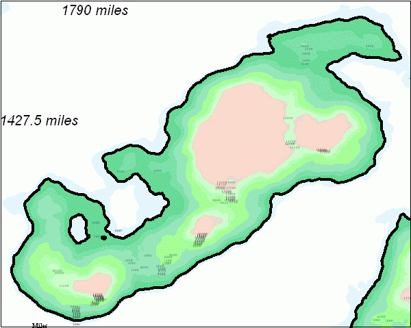
Note the map size and border. The distances are from Info->Distance, and the map border was drawn using a hollow rectangle.
I then ‘save as’ a rectangular BMP.
Author
Bill George
Categories
Generic, map tutorials
Posted
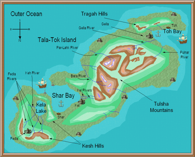
Now that I have the distances, I create an overland map using the distances as a guide for a ‘decide my own setings’ map..
Below is a map I drew using the bmp I imported as a guide.
The island with some detail.
Author
Bill George
Categories
General, map tutorials
Posted
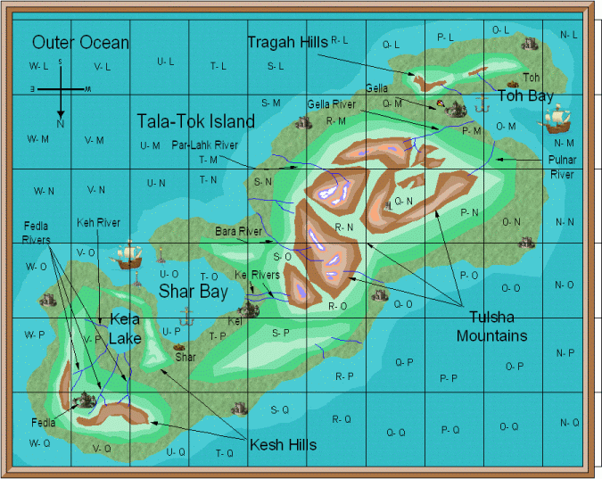
After the 185×234 mile hollow rectangles are drawn.
The U-L etc. are the surface map row and column coordinates.
I no longer make split maps like those shown here. April, 2015.
Author
Bill George
Categories
General, map tutorials