"Welcome to Crest of a Star; these maps and other graphics are only for playing D&D type games. They are copyright and not to be used for other purposes. If you have them on your site, please remove them. Thank you."

"My maps are free. If you purchased them, you got scammed."
"Not for redistribution or resale. Hyperlinking from Pinterest or other such share sites is prohibited."


Posted

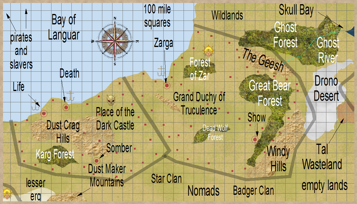
An area of NG and LE surrounded by Wildlands and the Grey Sea. A sea of pirates and slavers.

The two Nomads clans are lawful. The nation in the lower left corner of the map is The Land called ‘Shore’.

Dead Wolf Forest has undead wolves roaming it.

The Forest of Zar has some sort of mechanism wandering around in it.

The red circles are cities, the red squares are major castles.


Author
Categories South Hemisphere, Place of the Dark Castle

Posted

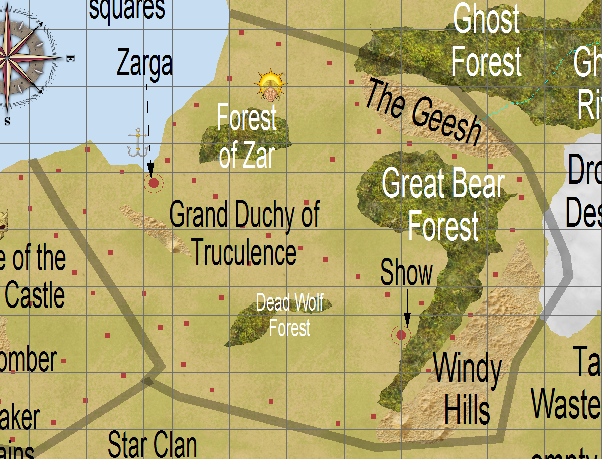
A neutral good nation that fights evil in areas near them. They have not heard of Trillolara, but would likely ally with them if the two nations knew of each other. Communications would be the big problem.

There is a seaport here, but the ships that arrive and leave from here are harassed by slavers and pirates from the Stormy Reaches islands.

There are a number of online definitions for the word ‘truculence’. I prefer: defiant aggressiveness

The red circles are cities, the red squares are major castles.


Author
Categories South Hemisphere, Grand Kingdom of Truculence

Posted

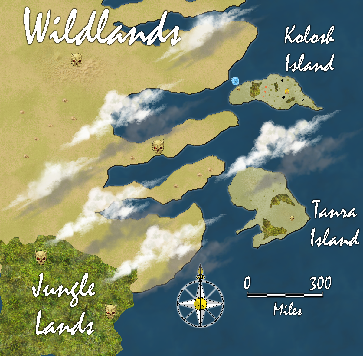
An interesting island in that with a planet of new types of castles and city walls, theirs is ancient.

Humans mostly, a few half-elves, and a few elves. Occasionally gnomes will visit, but they seldom stay.

Crops, sea fishing, some trade, and eagles inland.

A bit of Evil on the Northwest corner. Over by the whirpool.


Author
Categories Outer Ocean, Islands

Posted

A small island between the continent’s Wildlands and the Northern Islands.

Inhabited for a few decades, they all eventually left due to lack of trade.

A few ruined keeps, disintegrated wooden buildings, jungle and mountains.

The island is approximatrly 61,000 square miles in size.

Why did the buildings become abandoned ? They are near an island group. There should have been plenty of trade.

Maybe something else happened ?


Author
Categories Outer Ocean, Islands

Posted

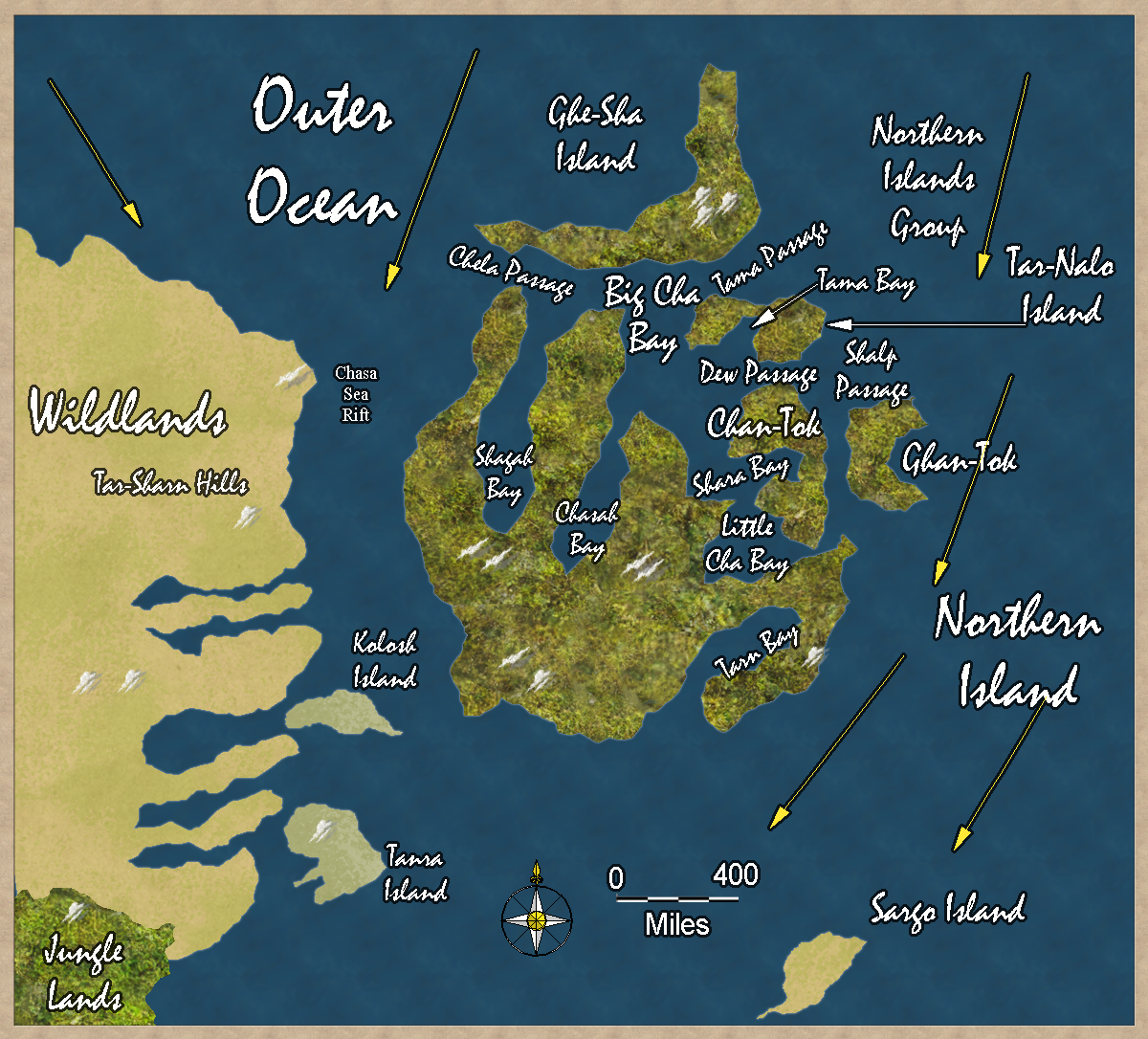
Trillolara and Dank Forest are off to the southwest of this map, over 3,500 miles away. The inhabitants of these islands have never heard of them.

Trillolara and Dank Forest are off the the southwest.

Each map square is 200 × 200 miles. North is at the top of the map. The yellow arrows are warm ocean currents from the tropics.

Updated map on March 22, 2020.


Author
Categories Outer Ocean, Northern Island


Privacy policy: I track IP addresses and pages looked at out of a vague curiosity to learn what pages are looked at on my site. After a set period, this information is deleted. No personal information is permanently kept.


[ Copyright © by Jim, 1980-2050. All Rights Reserved. ]

[ Except where noted, and where copyrights are held by others. ]